Minerva Singh is a PhD Candidate at the University of Cambridge and she is involved with the BES Conservation Ecology Special Interest Group. Her research focusses on using high resolution airborne data for mapping forest biophysical parameters and evaluating the impact of anthropogenic disturbances on them in the tropical ecosystems of the Greater Mekong region. In this post Minerva looks at harnessing the power of Google Earth for studying landscape-scale variation in above-ground biomass in tropical forests in Cambodia.
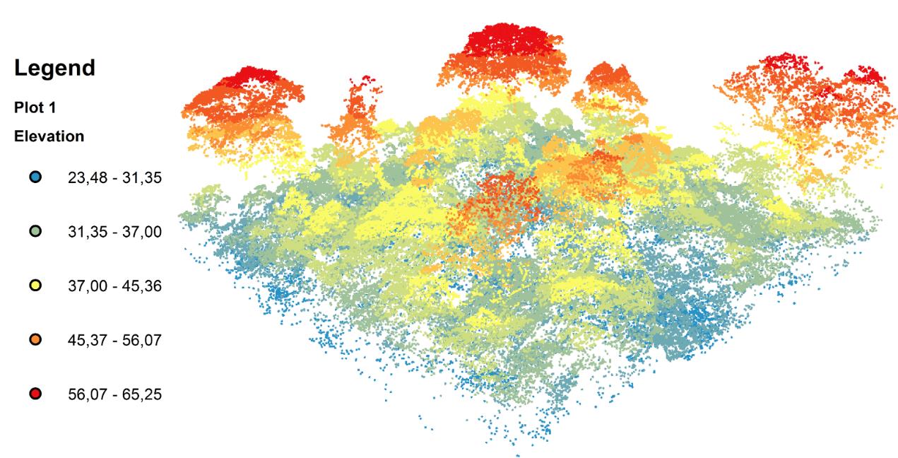
According to the popular environmental website Mongabay, Google Earth has been extensively used for facilitating environmental monitoring. From the remote monitoring of the uncontacted tribes in the Amazon to discovering new species to monitoring forest loss in real-time, Google Earth has lent itself to a slew of ecological and environmental monitoring endeavours. Google Earth is also a valuable source of freely available high resolution multispectral imagery, especially in the Asian tropics. The main aim of our research was to examine if very high resolution (VHR) aerial imagery extracted from Google Earth could be used to estimate the above-ground biomass (AGB) variation in a tropical forest ecosystem and how such estimates compared to models employing Light Detection and Ranging (LiDAR), which allows for modelling forest canopies in 3D, and commercial VHR imagery. As the LiDAR-generated 3D model shows, individual tree canopies can be identified from individual point clouds and we can identify trees of different heights in the landscape.
LiDAR has been used extensively deriving estimates of the vertical structure of the forest canopy (and subsequently AGB). Additionally, LiDAR-based analyses have been used for quantifying structural parameters of individual tree species and studying animal ecology and habitat preferences among others. However these data are expensive to acquire.
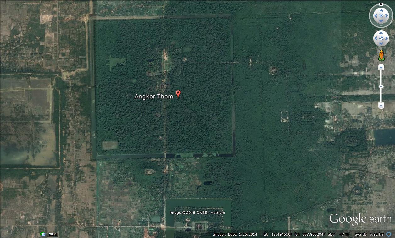
Our study was conducted at Angkor Thom, a UNESCO World Heritage site located in north-west Cambodia.
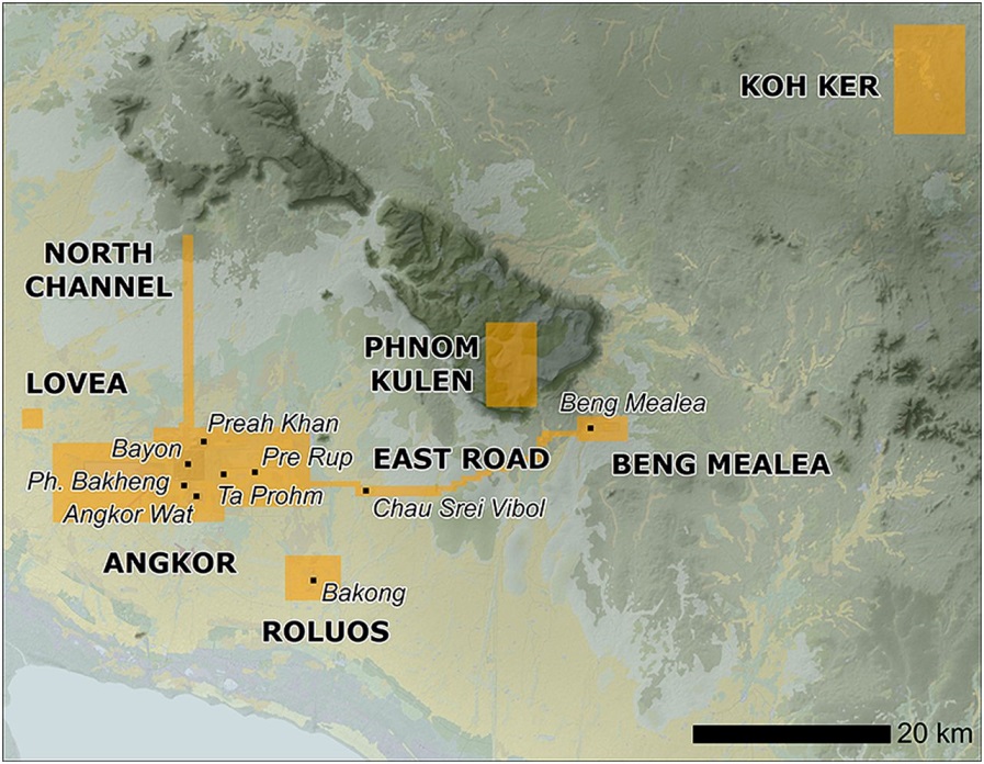
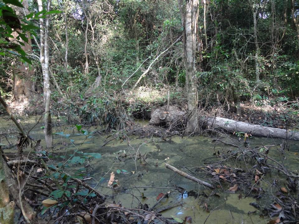
Very little forestry research has been done in Cambodia. A part of this can be attributed to the continued presence of landmines in the Cambodian forests; a legacy of its past political turmoil and war. Post-war Cambodia has seen a sharp acceleration in deforestation rates, and we hypothesized that cheaply/freely available landscape-scale VHR imagery could potentially allow for landscape-scale AGB modelling with limited field data. The forested areas around Angkor Thom are a microcosm for the deforestation and forest degradation that plagues the rest of Cambodia. Despite its protected status, forests of our study area show signs of considerable anthropogenic disturbance.

High resolution multispectral data of 50-cm resolution was extracted from Google Earth and these data were used in conjunction with ground-derived canopy cover (and LiDAR-derived tree heights) within a novel Machine Learning framework.
Several predictive models were developed which focussed on comparing the performance of Google Earth-based predictions with LiDAR-based models and models using commercial VHR with 8-cm resolution.
We built three models: (a) combination of LiDAR-derived canopy heights with texture variables derived from VHR aerial imagery (both the 50-cm Google Earth and 8-cm commercial multispectral data) and ground measured canopy cover, (b) combination of texture variables derived from VHR data and ground measured canopy cover values and (c) texture variable-based AGB models only. From our research we discovered that models that included LiDAR-derived tree heights produced the most robust AGB estimates. While this was an expected result, we discovered that in most of the cases, Google Earth-based models outperformed the models using commercial VHR imagery. Further the models that used a combination of Google Earth-based texture variables in conjunction with ground-based canopy cover performed almost as well as models with LiDAR height estimates.
These results potentially have significant ramifications. They indicate that freely available VHR images extracted from Google Earth can perform nearly as well as the more expensive data sources such as LiDAR and commercial aerial photos. Additionally we have identified a number of techniques, including novel machine learning methods which can allow us to harness the power of Google Earth for modelling forest biophysical parameters such as AGB. These findings are very important for poor countries such as Cambodia where acquiring expensive aerial data at large scales may not be feasible. In future, through the use of Google Earth-derived data we plan to build predictive models of AGB (and how they are affected by varying levels of anthropogenic disturbance) for larger areas.

3 thoughts on “Harnessing the power of Google Earth”