
We’re turning our attention to wide-ranging animals, specifically jaguars of Central America. Lisanne Petracca discusses her recent article, Robust inference on large-scale species habitat use with interview data: The status of jaguars outside protected areas in Central America.
The team also share video summaries of their work in English and Spanish.
For wide-ranging animals such as our focal species, the jaguar (Panthera onca), it is difficult to ascertain species status – whether it be presence, habitat use, or density – at the large spatial scales relevant to species persistence. The goal of our paper was to effectively inform conservation planning for jaguars across the entirety of Central America, where the current conservation paradigm comprises core jaguar populations connected by habitat corridors. Incorporating data from 12 corridors across six countries required some creative solutions to effectively account for jaguar detection and evaluate jaguar habitat use across the landscape.
Traditionally, species distribution models have used a combination of presence and “pseudo-absence” points to identify habitat that is most suitable for the target species. The one factor that this method fails to incorporate is detection: the failure to observe a species doesn’t mean the species isn’t there! It could be that individuals were missed by the observer, or are present at a time of day or year that differs from the time the survey was conducted. Failing to detect a species when it is actually present leads to flawed inference — most worryingly the underestimation of species presence and distribution.
Occupancy modeling is designed to provide more robust estimates of species presence by incorporating the detection process, teasing apart if the species is there to begin with and, if yes, the probability of detecting it. The key to separating these two processes is replicate surveys of a site, which has generally involved repeated visits over time or camera traps placed in an area for many nights.

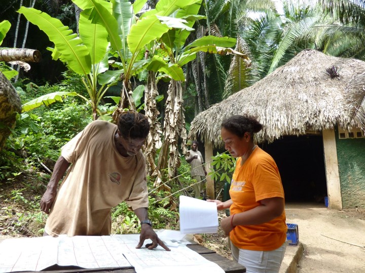
For a study area as large as ours (~45,000 km2 and 1,442 survey units) and falling squarely in private lands, it would be impractical and prohibitively expensive to conduct on-foot surveys or set up camera trap grids (not to mention the risk of camera trap theft). Thus, we employed a method pioneered by Kathy Zeller and colleagues in 2011 to use local residents as informants using semi-structured interviews. By conducting interviews of multiple people who were knowledgeable about wildlife in a given area (and whose knowledge extends well beyond the radius of a camera trap), we were able to collect information about species presence across vast areas in a relatively cost and time-efficient manner. However, using interview data posed a specific challenge for modeling in that records of animal detection were prone to both false negatives (people failing to report jaguar presence when jaguars were, in fact, present) and false positives (people may have misidentified the species, or accidentally reported on a different area).
We faced a couple of other challenges that likely plague other large-scale ecological studies. First, data collection across the 12 corridors took a long time – six years -which introduced noise, or heterogeneity, into the analysis. Individual corridors took from as little as six to eight weeks (Central and Southern Belize) to four years (Bosawas-Wawashang in Nicaragua) to complete, so we had to incorporate how detection within and among corridors may have changed across that time. Secondly, there were different baseline levels of jaguar presence in each corridor, as we knew Belize would have very high jaguar presence while other countries, such as Honduras, would have fewer and more elusive individuals.
How did we tackle this complexity? We started with an occupancy model developed by Andy Royle and Bill Link in 2006 that incorporates false positives in addition to false negatives. We then used the flexibility of a Bayesian approach, namely the incorporation of random effects, to model the heterogeneity induced by survey inequities across time and space. More specifically, we used a random effect of each corridor-specific field season to model changes in the detection process that may have occurred over time, and a random effect of corridor to model baseline differences in occupancy. This approach permitted a more complete accounting of model uncertainty and led to robust estimates of jaguar habitat use in each of our 1,442 sampling units across 12 jaguar corridors in Central America.
What did we learn? Jaguars had a higher probability of habitat use in forested areas close to protected areas, away from major settlements, and with greater prey richness. Corridor status ranged from strong (both Belize corridors had >90% mean probability of jaguar habitat use) to uncertain (the Western and Central Honduras corridors had <20% mean probability of jaguar habitat use). The latter result provided a second line of evidence indicating the threatened status of jaguar populations in Honduras, with Claudia Wultsch and colleagues reporting little gene flow between jaguar populations in Honduras and those to the west. A concerning observation in our study was that the corridors having the highest mean probability of use by jaguar have also had the highest rates of deforestation in the last five years, meaning that even corridors with apparently strong jaguar presence may soon be imperiled and at risk of geographic isolation.
It is our hope that our results will advance the field of occupancy analysis while also helping to direct conservation action for jaguars in Central America. All of our data and R code is on Dryad if you are interested in implementing a similar analysis and/or improving upon our methodology.
Read the full article, Robust inference on large-scale species habitat use with interview data: The status of jaguars outside protected areas in Central America in Journal of Applied Ecology.
A Spanish video summary is also available

One thought on “Jaguar habitat use outside protected areas in Central America: accounting for the detection process generates new insights”