
Marine Protected Areas (MPAs) are designated regions to help conserve wildlife but how are they used by the species they protect? In their latest research, Kelsey Roberts and colleagues evaluate the use of these protected areas by sea turtles to help inform better design and management of MPAs.
Scientists agree that area-based conservation efforts are key to preserving biodiversity and ecosystems, as well as ocean-based livelihoods. A global coalition comprised of over 50 countries recently agreed to expand protected areas to cover at least 30% of land and ocean by the end of the decade. However, designing protected areas for the conservation of highly mobile species has always been a challenge, both on land and in the ocean.
Though the conservation of large marine megafauna (e.g. sharks, whales, sea turtles) has become a driving force behind the establishment of many marine protected areas (MPAs), these species are often migratory and seasonally move outside of the protected area’s boundaries. Therefore, understanding and quantifying how existing protected areas can benefit these mobile species is crucial.
As a keystone species, sea turtles play an important role in ecosystem function and balance. Nearly all species and sub-populations of sea turtles are now considered imperiled due to threats such as overharvesting, fisheries bycatch and climate change. Through decades-long efforts in satellite tracking, we have learned a lot about their distribution and movement patterns. As the global race to establish a larger network of MPAs continues, determining movement patterns and home ranges of these animals can help inform design and management frameworks.
To ensure these frameworks are as effective as possible, understanding how these animals interact with existing protected area boundaries is necessary. Specifically, are sea turtles using protected areas, and for what purpose?

The research
In our new study, we assessed whether sea turtles used Florida MPAs in greater proportion to their availability and if turtle behavioural state (i.e. transiting or foraging) influenced this selection.
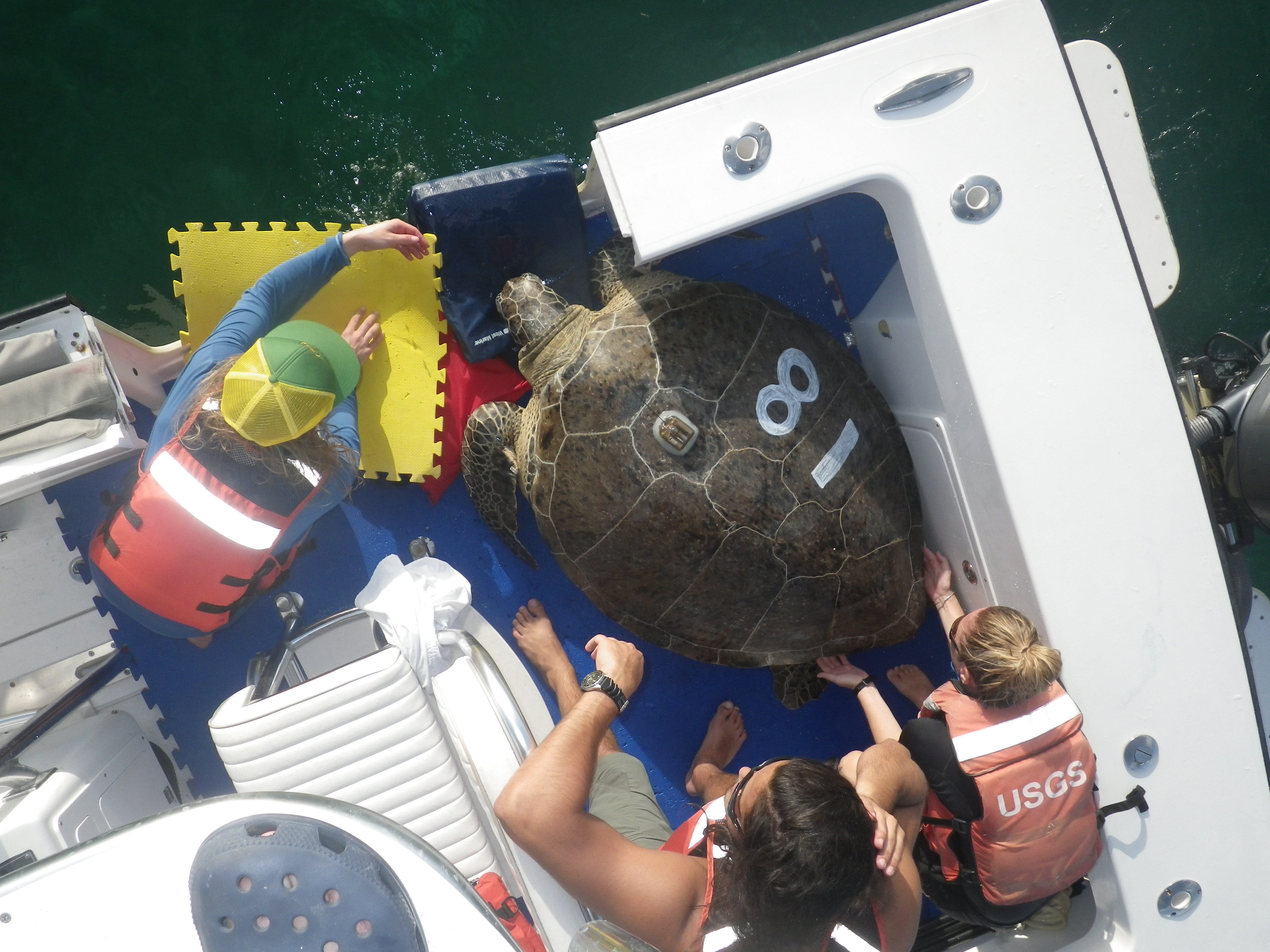
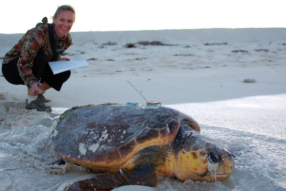
To do this, we analysed data from an 11-year satellite tracking effort that included 235 individual turtles tagged in four locations around the Gulf of Mexico and Atlantic (3 in Florida, 1 in Alabama). Three species of sea turtle were represented in this analysis: loggerhead (Caretta caretta, n=161), green (Chelonia mydas, n=70), and hawksbill (Eretmochelys imbricata, n=4).
We constructed a habitat selection model using two unique modelling techniques: switching state space modelling (SSM) and integrated step selection analysis (iSSA). The purpose of the SSM was to estimate the fine-scale location and behavioural state (either transiting or foraging) of the animal at regular time intervals, and the iSSA compared the attributes of an animal’s observed “steps” with alternative, randomly-generated steps available to the animal at the same starting point.
These complementary tools allowed us to determine that turtles typically select for protected area boundaries within our study region despite having alternative habitat available to them.
We further examined this selection at the zone scale. Many MPAs are divided up into zones to designate which activities are permitted. No-take zones within MPAs prevent any extractive uses (e.g., fishing, collecting, trawling) while still allowing for some recreational activities such as scuba diving or snorkelling. Numerous studies have shown that no-take zones are more effective at preserving or restoring biodiversity in MPAs, in comparison to multi-use zones or surrounding fishing areas.
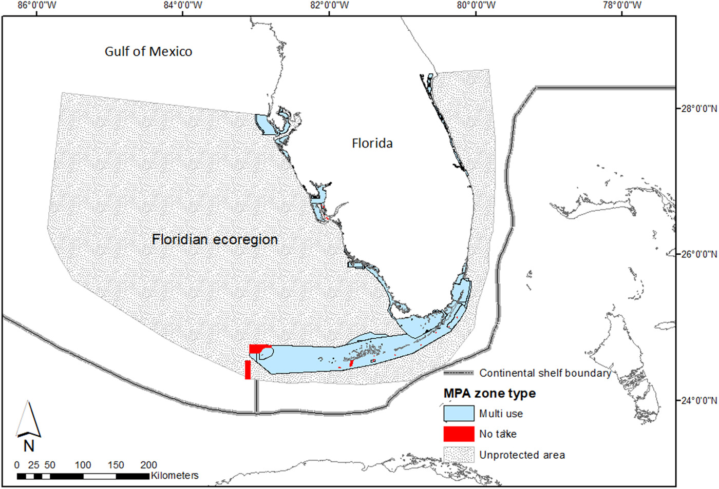
Our model showed that turtles did actively select for multi-use zones in protected areas while transiting and foraging. No-take zones however were used by turtles, in either direct proportion to their availability or less than, in both behavioural states. One possible explanation for this finding is that no-take zones in our study region were rare and small, thus making it difficult for our models to account for these areas with a high degree of certainty. Additionally, it is possible that these zones are poorly designed for these species.
Our results could therefore be used as a predictive tool to inform rezoning efforts of existing protected areas, such as the Florida Keys National Marine Sanctuary, and to help identify good candidate areas for zone upgrades.
Today, only about 7% of the global ocean is protected, well under the ambitious 30% target by 2030. Understanding animal movement patterns can help inform the design and planning process of new MPAs, and satellite tracking studies and robust spatial modelling techniques are critical tools in obtaining this information. At a time when conservation management faces unprecedented ocean changes, our findings indicate that holistic, adaptive approaches can help mitigate biodiversity loss.
Read the full article: “Evaluating the use of marine protected areas by endangered species: A habitat selection approach” in Issue 2:1 of Ecological Solutions and Evidence.
