This guest post is by Kylie L. Scales (@KylieScales) on her recent review paper “On the Front Line: frontal zones as priority at-sea conservation areas for mobile marine vertebrates.”
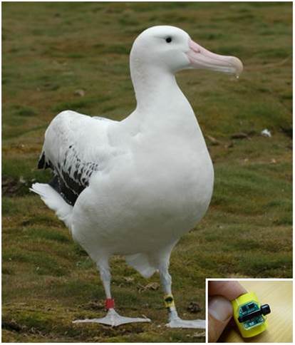
The oceans may seem like Earth’s last remaining wilderness, but are in fact teeming with human activity as a result of intense and growing demand for marine resources. Consequently, large marine vertebrates such as seabirds, turtles, sharks and whales – which spend most of their lives at sea – are under acute pressure from human-induced threats. Population-level impacts are now evident throughout the global ocean. For example, as many as 320,000 seabirds are killed each year through incidental capture (‘bycatch’) in longline fisheries, which target commercially valuable fish such as swordfish and tuna. Effective conservation solutions are urgently required, not only to ensure the survival of these oceanic icons for their own inherent value, but also to maintain the critical ecological functions that they perform.
However, designing conservation solutions is problematic. These animals inhabit vast, changeable habitats and range over great distances, complicating the design of strategies for threat management. We need tools to identify, monitor and manage priority conservation areas in the oceans, and to track responses to changes in marine habitats that will occur as a result of impending global climate change.
Our understanding of how physical processes in the ocean influence the movements of mobile marine vertebrates can help. The technological revolution in animal tracking (‘biologging’) over recent decades, coupled with enhanced capacity for measurement of ocean conditions from ship-board sensors, satellites and autonomous vehicles, has greatly improved our understanding of how free-living animals use their environment.
Many species are now known to associate with oceanic features such as seamounts – underwater mountain ranges – and ocean fronts. Fronts form where two water masses meet and occur throughout the oceans, ranging in scale from metres to thousands of kilometres in length. More persistent fronts that form where currents flow together are known to accumulate nutrients, plankton and small fish, and so can become foraging ‘hotspots’ for large marine vertebrates. In addition, some species of conservation concern, such as sea turtles, have been shown to migrate along ocean-basin scale fronts as they move between different sites used for breeding and foraging. Alarmingly, major fronts are known to be areas of overlap between these important at-sea habitats and the concentration of fisheries activity, and so may also be ‘hotspots’ of threat, both in coastal regions and the open oceans.
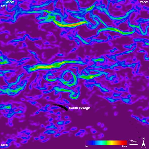
Satellite technologies – our ‘Eyes in the Sky’ – could form part of the solution. Satellites can be used to automatically detect fronts anywhere in the global ocean, and track how they change through time. We can therefore identify regions where fronts often form (‘frontal zones’) – a tool which could prove useful in locating and monitoring priority conservation areas for mobile marine vertebrates. As part of a suite of tools supporting next-generation ocean management (e.g. vessel monitoring technologies, marine biodiversity observation networks), front mapping has potential to help us balance the competing demands of human activity and biodiversity conservation in the oceans. Integration of these technological innovations is vital if we are to ensure the survival of wide-ranging marine vertebrates into the future.
