In this post Miguel Clavero writes about his recent paper with Virgilio Hermoso: “Historical data to plan the recovery of the European eel”
Once there were European eels all around. Plenty of them. From its breeding grounds around the Sargasso Sea the eel used to colonize European and Northern African aquatic systems in such numbers that it lead to one of the few commercial freshwater fisheries in the region. But eel numbers collapsed in the last quarter of the 20th century, with recorded declines in the catches of both juveniles and adults often exceeding 90%. The species is nowadays considered to be outside safe biological limits (e.g. see here for the last report of the ICES working group on eels) and has been categorised as critically endangered in the IUCN Red List.
The socioeconomic relevance of the eel is translated in the unique, species-level legislation that the European Union established to promote its recovery. According to this regulation, EU member states must work at the basin level to allow “the escapement to the sea of at least 40% of the silver eel biomass relative to the best estimate of escapement that would have existed if no anthropogenic influences had impacted the stock”. This target raises an obvious question: what were pristine eel stocks like? Although some amazing long-term fisheries records do exist, in the vast majority of the eel range there is a complete lack of information about pre-collapse eel abundances. To overcome this information gap Virgilio Hermoso and I propose to change abundance-focussed eel recovery targets with spatial-focussed ones. In fact, the collapse of the eel has had an important spatial component, with huge range losses related to river fragmentation by dams. But here comes the question again: is there enough information to describe the eel range before critical human impacts? And in this case the answer is yes. As for other socioeconomically relevant species, there is a large amount of historical information on the distribution of the eel, but as yet it has been used only sparsely.
Several geographical description initiatives were developed in the 18th and 19th centuries, and occasionally before, in most European regions. Most of these works compiled information on natural resources, including forests, game and harmful animals and fisheries, which can be georeferenced with acceptable precision, thus producing data sets that are similar in format to present-day biodiversity databases. In our work we used these kind of historical sources to characterise the pristine range of the eel in the Iberian Peninsula and to generate a baseline range that should serve to set spatially-explicit recovery targets for the species.
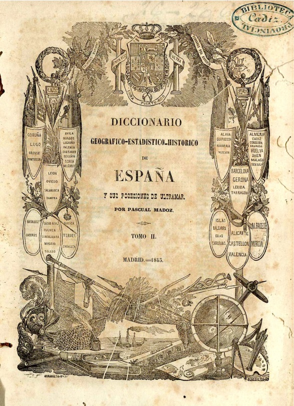
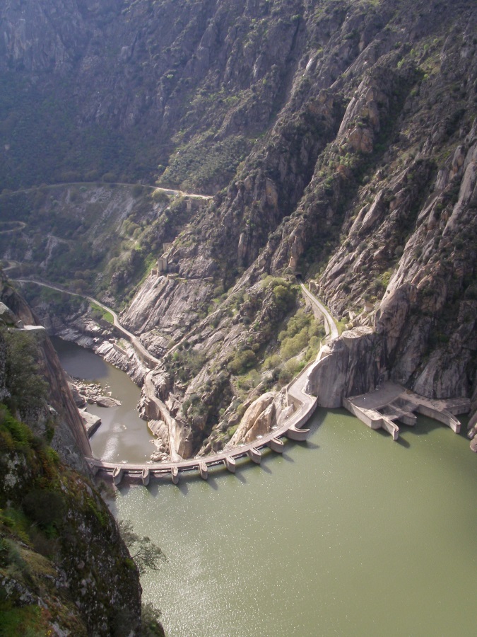
Virgilio and I collected and georeferenced all (at least we tried for it to be all) the information about freshwater fish included in the geographical dictionary of Spain edited by Pascual Madoz (the Madoz) between 1845 and 1850. The Madoz is a 16-volume, almost 12,000-page work that involved the collaborative work of some 1,400 informants for more than 10 years. We gathered 10,223 species- or genus-specific freshwater fish records from 5,427 localities, including 2,815 eel records. We used this information to model eel distribution in the mid-19th century and produce a baseline range for the species in the Iberian Peninsula. We followed a similar approach to describe the eel range in the 16th century and for the present. In the first case, we collected information from the Relaciones Topográficas, a series of questionnaires developed in central Spain in the late 16th century. The high correspondence of the model outputs using 16th and 19th century data (two totally independent data sets separated by almost 300 years) reinforced the notion that the 19th century data could be used to build a baseline range for the eel in the Iberian Peninsula. We modelled present-day distribution based on record data from GBIF, showing that the eel has lost more than 80% of its range in the Iberian Peninsula in the last 150 years. The spatial patterns in range loss clearly relate to the loss of connectivity in river systems due to dams.
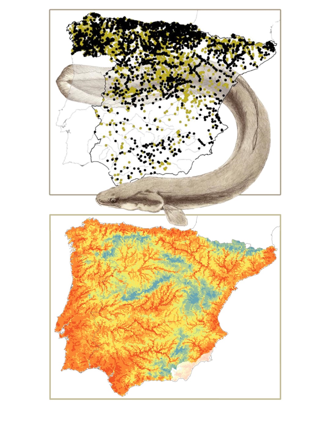
Lower map: Probability of occurrence of the eel in the Iberian Peninsula in the 19th century, based on the records shown above. Estimates derive from the ensemble species distribution models using BIOMOD2.
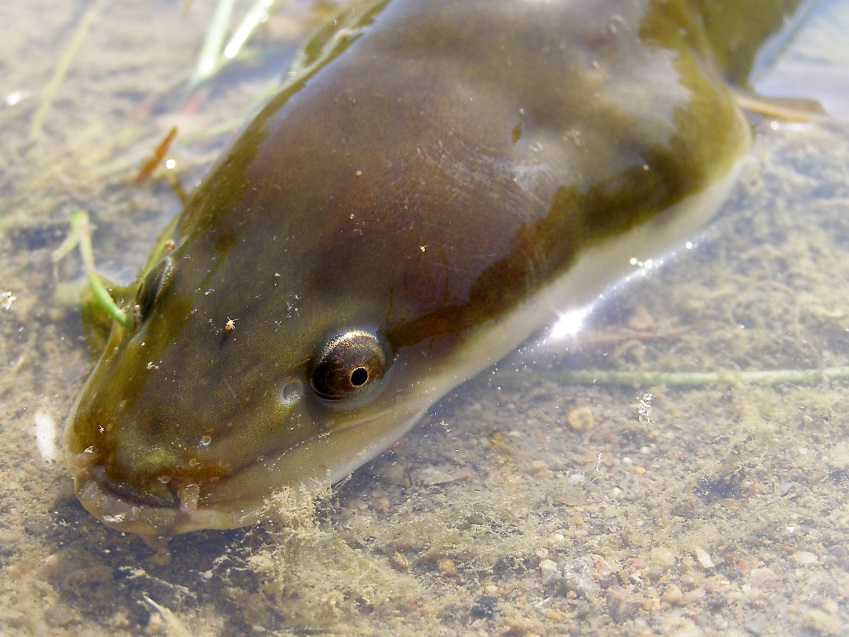
Eel drawing by Miguel Clavero.
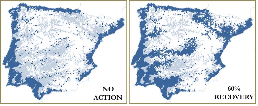
As an application of our description of the eel baseline range we identified the minimum number of reservoirs that should be managed (i.e. made passable) in order to allow the species to occupy specific percentages of its pristine range. We thus exemplified how historical information allowed setting spatial-focussed recovery targets that could be translated into specific management action. We propose that historical baseline ranges and associated spatial recovery targets should become a critical component of the European Union regulations aimed at the recovery of the eel.
The extraction of biodiversity information from historical sources is a tedious and challenging task that intrinsically involves cooperative work (e.g. between researchers from different disciplines and speakers of different languages). Gathering this information is the most straightforward option to establish valid baseline scenarios and realistic conservation targets for several threatened species, especially for those species that, like the eel, have been socioeconomically relevant. The data are there, in several historical, often freely accessible sources, just waiting for someone to filter, use and distribute them. In doing so we will improve our knowledge of the long-term dynamics of natural systems and their human influences.
